NYC Metro Art Station Works
Interactive mapping of all NYC subway art works, allowing to explore the permanent art catalog since 1980.
❌ Before
- Art works catalog in spreadsheet format
- No geographical view of works
- Difficulty exploring works by period
✅ After
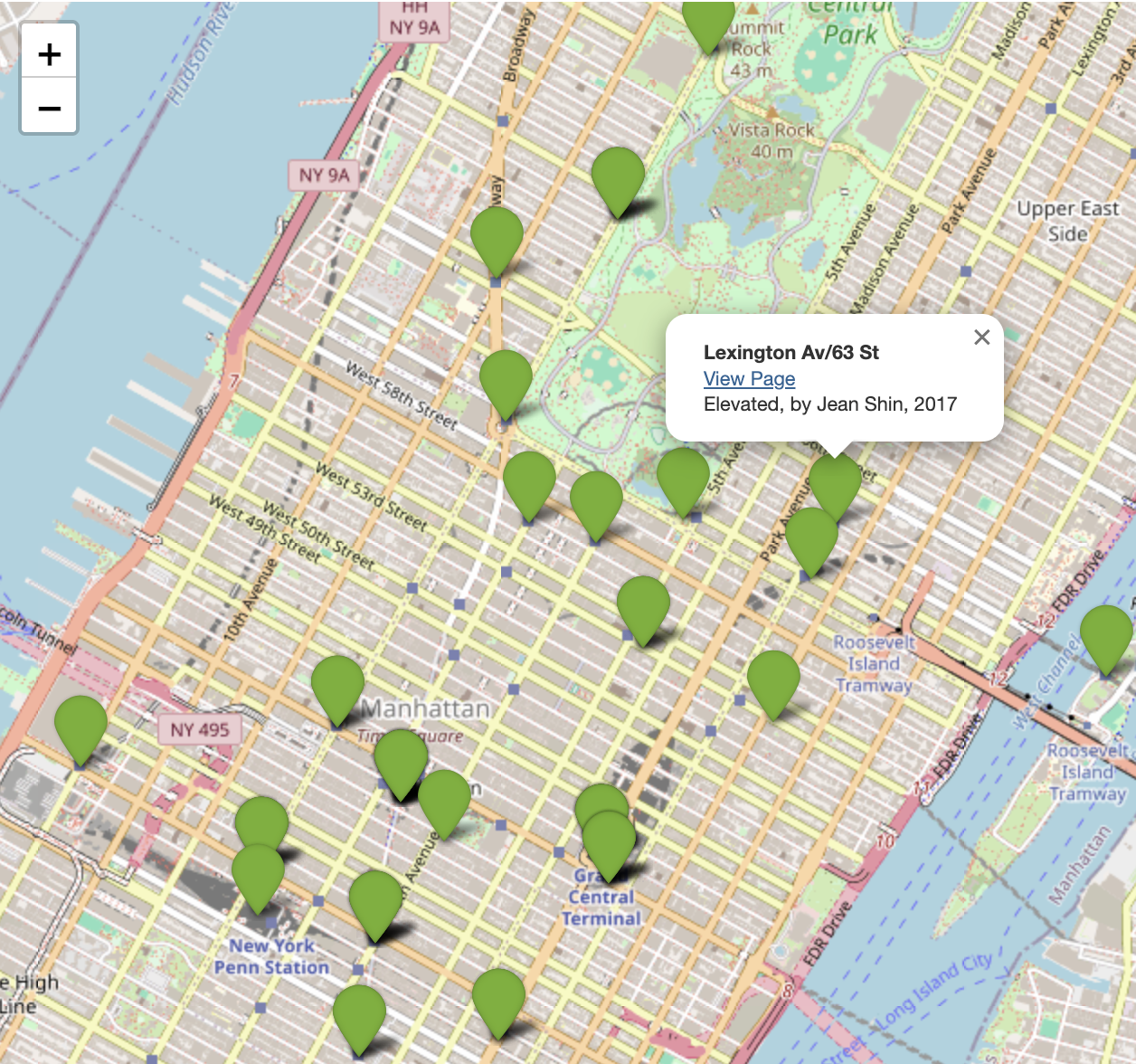
- Interactive map with all geolocated works
- Filtering by decade to see evolution
- Detailed information on click (artist, title, date)
- Direct links to work pages
Methodology
1. Data preparation:
Using Python and the Pandas library, I matched each work from the "Permanent Art Catalog" with the coordinates of its respective station (latitude and longitude) from the "Subway Stations" dataset. This process allowed linking each work to the precise geographical location of its station.
2. Interactive map creation:
Using Python's Folium library, an interactive map was generated to display works available in the New York subway network.
- For each station, a pop-up window provides the station name, a link to the work page, the work title, artist and date.
- Filterable layers allow users to visualize works by decade and by artist genre, offering a chronological perspective on the evolution of public art in the subway network.
Python
Pandas
Folium
Data from MTA (Metropolitan Transportation Authority) - Permanent Art Catalog since 1980 and MTA Subway Stations (October 9, 2024)
Free
To access this map, send me an email:
Request access by email